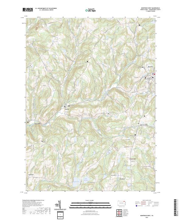
2023 Map of Montrose West
USGS Topo · Published 2023About this map
Fairdale and South Montrose anchor a landscape defined by the branching tributaries of the Wyalusing Creek in this modern-era documentation of Susquehanna County. The map provides extensive detail for genealogists, including numerous family and church burial grounds such as the Cornwell Family Cem, Prospect Hill Cem, and the Saint Paul's Episcopal Church Columbarium in the county seat at Montrose. The upland terrain rises toward Billy Goat Mountain and Louden Hill, while the lowlands are punctuated by significant water bodies like Big Elk Lake, Little Elk Lake, and Indian Lake. Smaller hamlets like Snows Mill and East Rush are situated along a complex network of local roads and state routes, reflecting the persistent rural settlement patterns that have characterized this part of Pennsylvania for generations.
Find a feature on this map
112 named features on this map. Tap any name to fly to it.
Don’t see what you’re looking for? This feature index may not catch every label — zoom into the map to look around manually.
Map Details
Editions of this 2023 Montrose West Map
This is the sole edition of this map. No revisions or reprints were ever made.
Other maps of this area

1943 · Montrose
USGS Topo · 1:62,500

1943 · Le Raysville
USGS Topo · 1:62,500

1945 · Montrose
USGS Topo · 1:62,500

1945 · Le Raysville
USGS Topo · 1:62,500

1945 · Meshoppen
USGS Topo · 1:62,500

1945 · Auburn Center
USGS Topo · 1:24,000

1946 · Tunkhannock
USGS Topo · 1:62,500

1946 · Springville
USGS Topo · 1:24,000

1946 · Hop Bottom
USGS Topo · 1:24,000

1947 · Hopbottom
USGS Topo · 1:24,000