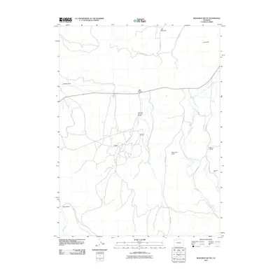
2010 Map of Monument Butte
USGS Topo · Published 2010About this map
The settlement of Loyd and the nearby Iles Grove anchor this 2010 survey of a resource-rich landscape in Moffat County. The map details the industrial footprint of the region, specifically the Iles Dome Oil Field and the Weisbeck Mine, illustrating the intersection of energy extraction and the natural topography. A network of county roads, including County Rd 45 and County Rd 47, connects these remote sites across a terrain defined by dramatic drainages and high points. The namesake Monument Butte rises as a central landmark, while the northern edge is dominated by the slopes of Iles Mountain. Water systems are meticulously mapped, from the larger Morapos Creek and Milk Creek to the specifically named seasonal washes like Seeping Spring Gulch and Stinking Gulch, providing a detailed view of the watershed and ranching access points as they existed in the early 21st century.
Find a feature on this map
20 named features on this map. Tap any name to fly to it.
Don’t see what you’re looking for? This feature index may not catch every label — zoom into the map to look around manually.
Map Details
Editions of this 2010 Monument Butte Map
This is the sole edition of this map. No revisions or reprints were ever made.
Other maps of this area

1910 · Danforth Hills
USGS Topo · 1:125,000

1912 · Meeker
USGS Topo · 1:62,500

1912 · Axial
USGS Topo · 1:62,500

1914 · Meeker
USGS Topo · 1:62,500

1914 · Axial
USGS Topo · 1:62,500

1915 · Monument Butte
USGS Topo · 1:62,500

1954 · Craig
USGS Topo · 1:250,000

1957 · Craig
USGS Topo · 1:250,000

1958 · Craig
USGS Topo · 1:250,000

1960 · Craig
USGS Topo · 1:250,000