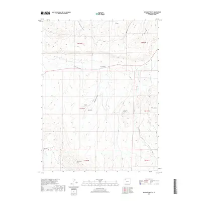
2019 Map of Monument Butte
USGS Topo · Published 2019About this map
The Axial Basin floor serves as the geographic heart of this Moffat County survey, where the small community of Loyd and the nearby Iles Grove represent the primary points of human settlement. The landscape is defined by its drainage systems and prominent peaks, including Iles Mtn in the north and the namesake Monument Butte rising in the east-central region. To the south, Thornburgh Mtn anchors the terrain where Milk Cr and Morapos Cr transition through the valley. This 2019 data illustrates a high-desert environment where water sources like Ralston Springs are critical landmarks. Local transit is managed via a network of county roads such as Co RD 47 and Co RD 41, which follow the contours of the numerous gulches including Sulphur Gulch, Stinking Gulch, and Seeping Spring Gulch. These features together show a region dominated by ranching and resource-management infrastructure within its township and range grid.
Find a feature on this map
27 named features on this map. Tap any name to fly to it.
Don’t see what you’re looking for? This feature index may not catch every label — zoom into the map to look around manually.
Map Details
Editions of this 2019 Monument Butte Map
This is the sole edition of this map. No revisions or reprints were ever made.
Other maps of this area

1910 · Danforth Hills
USGS Topo · 1:125,000

1912 · Meeker
USGS Topo · 1:62,500

1912 · Axial
USGS Topo · 1:62,500

1914 · Meeker
USGS Topo · 1:62,500

1914 · Axial
USGS Topo · 1:62,500

1915 · Monument Butte
USGS Topo · 1:62,500

1954 · Craig
USGS Topo · 1:250,000

1957 · Craig
USGS Topo · 1:250,000

1958 · Craig
USGS Topo · 1:250,000

1960 · Craig
USGS Topo · 1:250,000