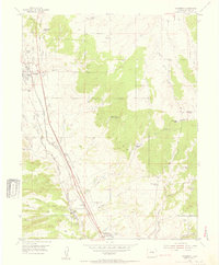
1954 Map of Monument
USGS Topo · Published 1955About this map
Palmer Lake and Monument serve as the primary hubs in this mid-century look at El Paso County, where the transition from high-plains ranching to foothills settlement is clearly visible. The landscape is defined by its drainage systems, including Dirty Woman Creek and Monument Creek, which flow through a corridor dominated by major transportation arteries. The Atchison Topeka and Santa Fe and the Denver and Rio Grande Western railroads run parallel through the valley, highlighting the historical importance of this rail link between Denver and points south.
Find a feature on this map
42 named features on this map. Tap any name to fly to it.
Don’t see what you’re looking for? This feature index may not catch every label — zoom into the map to look around manually.
Map Details
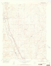
Editions of this 1954 Monument Map
2 editions found
Other maps of this area

1893 · Colorado Springs
USGS Topo · 1:125,000

1894 · Castle Rock
USGS Topo · 1:125,000

1909 · Colorado Springs
USGS Topo · 1:125,000

1913 · Castle Rock
USGS Topo · 1:125,000

1940 · Elbert
USGS Topo · 1:62,500

1942 · Colorado Springs
USGS Topo · 1:125,000

1944 · Elbert
USGS Topo · 1:62,500

1948 · Colorado Springs
USGS Topo · 1:62,500

1948 · Pikeview
USGS Topo · 1:24,000

1948 · Cascade
USGS Topo · 1:24,000