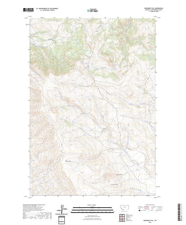
2024 Map of Monument Hill
USGS Topo · Published 2024About this map
Monument Hill stands as a primary landmark in this section of Beaverhead County, overlooking a network of drainages and high-country routes. The landscape is defined by its numerous gulches and draws, including Whiskey Draw, Buggy Gulch, and Boulder Gulch, which feed into larger watercourses such as Sage Creek and Clark Canyon. The presence of Sage Creek Rd and various Bureau of Land Management markers like blmtc4 indicates the managed nature of this open range.
Find a feature on this map
21 named features on this map. Tap any name to fly to it.
Don’t see what you’re looking for? This feature index may not catch every label — zoom into the map to look around manually.
Map Details
Editions of this 2024 Monument Hill Map
This is the sole edition of this map. No revisions or reprints were ever made.
Other maps of this area

1893 · Dillon
USGS Topo · 1:250,000

1952 · Dalys
USGS Topo · 1:24,000

1952 · Gallagher Mountain
USGS Topo · 1:24,000

1955 · Dubois
USGS Topo · 1:250,000

1955 · Dillon
USGS Topo · 1:250,000

1957 · Dillon
USGS Topo · 1:250,000

1958 · Dubois
USGS Topo · 1:250,000

1958 · Dillon
USGS Topo · 1:250,000

1961 · Ashbough Canyon
USGS Topo · 1:24,000

1962 · Dillon
USGS Topo · 1:250,000