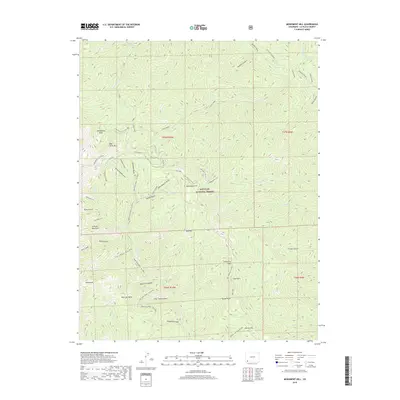
2019 Map of Monument Hill
USGS Topo · Published 2019About this map
The San Juan National Forest covers this high-elevation region of Southwest Colorado, where the terrain is defined by the eastern reaches of the La Plata Mountains. The landscape is a network of deep drainages and ridges, featuring prominent landmarks like Monument Hill and Olga Little Mtn. Water moves through the terrain via Hermosa Creek and its many tributaries, including S Fork Hermosa Cr and Clear Creek. Evidence of the area's mining history is preserved at the Neglected Mine located near Leavenworth Gulch. This map also traces modern recreational and administrative paths through the backcountry, such as the Junction Creek CO Trail and the Monument Hill Trl, which navigate between points like Cemetery Flats and Rands Point.
Find a feature on this map
55 named features on this map. Tap any name to fly to it.
Don’t see what you’re looking for? This feature index may not catch every label — zoom into the map to look around manually.
Map Details
Editions of this 2019 Monument Hill Map
This is the sole edition of this map. No revisions or reprints were ever made.
Other maps of this area

1895 · La Plata
USGS Topo · 1:62,500

1897 · La Plata
USGS Topo · 1:62,500

1897 · Rico
USGS Topo · 1:62,500

1898 · Durango
USGS Topo · 1:62,500

1898 · Engineer Mountain
USGS Topo · 1:62,500

1898 · Rico
USGS Topo · 1:62,500

1899 · La Plata
USGS Topo · 1:62,500

1899 · Rico
USGS Topo · 1:62,500

1900 · Engineer Mountain
USGS Topo · 1:62,500

1907 · Durango
USGS Topo · 1:62,500