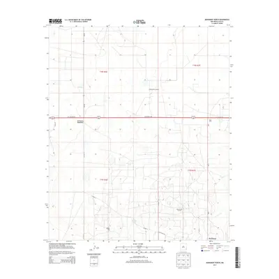
2013 Map of Monument North
USGS Topo · Published 2013About this map
Arkansas Junction and the northern reaches of Monument anchor this portion of the Permian Basin, where the high desert terrain is defined by a dense grid of energy infrastructure and ranching outposts. The Monument Jal Oil Field occupies a significant portion of the eastern landscape, illustrating the intensive industrial footprint of the region's petroleum economy. This industrial presence is further marked by the Maddox Power Company facility located north of the W Carlsbad Hwy.
Find a feature on this map
19 named features on this map. Tap any name to fly to it.
Don’t see what you’re looking for? This feature index may not catch every label — zoom into the map to look around manually.
Map Details
Editions of this 2013 Monument North Map
This is the sole edition of this map. No revisions or reprints were ever made.
Other maps of this area

1954 · Hobbs
USGS Topo · 1:250,000

1958 · Hobbs
USGS Topo · 1:250,000

1962 · Lovington
USGS Topo · 1:62,500

1963 · Monument
USGS Topo · 1:62,500

1969 · Humble City
USGS Topo · 1:24,000

1969 · Hobbs SW
USGS Topo · 1:24,000

1969 · Hobbs West
USGS Topo · 1:24,000
1985 · Monument North
USGS Topo · 1:24,000
1985 · Lovington SE
USGS Topo · 1:24,000
1985 · Lovington SW
USGS Topo · 1:24,000