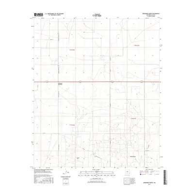
2017 Map of Monument North
USGS Topo · Published 2017About this map
Arkansas Junction serves as a primary geographic marker in this section of the Permian Basin, where the high desert terrain is defined by a grid of county roads and section lines. The landscape near Indian Hill reflects the sparse but essential infrastructure of Lea County, characterized by straight-line transport routes like Maddox Rd and Squires Rd. This survey documents a transition from the semi-arid plains to the small community of Monument in the southeastern corner.
Find a feature on this map
17 named features on this map. Tap any name to fly to it.
Don’t see what you’re looking for? This feature index may not catch every label — zoom into the map to look around manually.
Map Details
Editions of this 2017 Monument North Map
This is the sole edition of this map. No revisions or reprints were ever made.
Other maps of this area

1954 · Hobbs
USGS Topo · 1:250,000

1958 · Hobbs
USGS Topo · 1:250,000

1962 · Lovington
USGS Topo · 1:62,500

1963 · Monument
USGS Topo · 1:62,500

1969 · Humble City
USGS Topo · 1:24,000

1969 · Hobbs SW
USGS Topo · 1:24,000

1969 · Hobbs West
USGS Topo · 1:24,000
1985 · Monument North
USGS Topo · 1:24,000
1985 · Lovington SE
USGS Topo · 1:24,000
1985 · Lovington SW
USGS Topo · 1:24,000