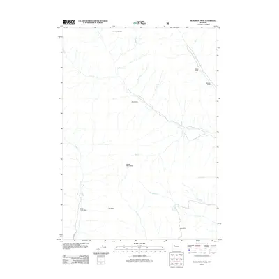
2012 Map of Monument Peak
USGS Topo · Published 2012About this map
Muddy Monument Peak and the striking Washakie Needles anchor this high-elevation landscape in Fremont County. The terrain is defined by a network of drainage systems, with S Fork Owl Cr and its tributaries like Needle Cr and Vass Cr carving through the northern reaches. The map reveals a land utilized for its open range and water resources, evidenced by named features such as Little Dry Muddy Spring and the natural catchments of Devils Hole and the Crow Creek Basin. Physical landmarks such as Bald Mountain and Trail Ridge provide clear orientation for those navigating this portion of the Absaroka Range. While the region is largely undeveloped, Crow Creek Rd provides a vital corridor through the southern half of the quadrangle, connecting the higher basins with the outlying draws like Black Draw and Buckle Draw.
Find a feature on this map
25 named features on this map. Tap any name to fly to it.
Don’t see what you’re looking for? This feature index may not catch every label — zoom into the map to look around manually.
Map Details
Editions of this 2012 Monument Peak Map
This is the sole edition of this map. No revisions or reprints were ever made.
Other maps of this area

1904 · Kirwin
USGS Topo · 1:125,000

1906 · Kirwin
USGS Topo · 1:125,000

1955 · Thermopolis
USGS Topo · 1:250,000

1958 · Thermopolis
USGS Topo · 1:250,000

1962 · Thermopolis
USGS Topo · 1:250,000

1967 · Willow Creek
USGS Topo · 1:24,000
1967 · Circle Ridge
USGS Topo · 1:24,000

1967 · Monument Peak
USGS Topo · 1:24,000
1967 · East Fork Basin
USGS Topo · 1:24,000
1967 · Johnson Draw
USGS Topo · 1:24,000