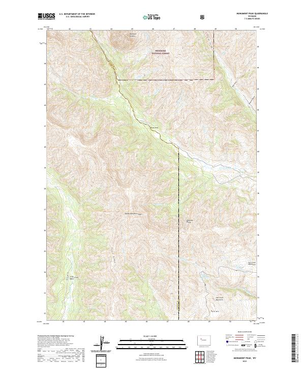
2021 Map of Monument Peak
USGS Topo · Published 2021About this map
The Shoshone National Forest landscape across the border of Fremont and Hot Springs counties is defined by dramatic elevation changes and a web of alpine drainages. The Absaroka Range dominates the central portion of the map, punctuated by the high point of Muddy Monument Peak and the prominent Washakie Needles to the north. These peaks overlook the headwaters of numerous creeks, including the westward-flowing Cabin Cr and the eastern-reaching S Fork Owl Cr.
Find a feature on this map
36 named features on this map. Tap any name to fly to it.
Don’t see what you’re looking for? This feature index may not catch every label — zoom into the map to look around manually.
Map Details
Editions of this 2021 Monument Peak Map
This is the sole edition of this map. No revisions or reprints were ever made.
Other maps of this area

1904 · Kirwin
USGS Topo · 1:125,000

1906 · Kirwin
USGS Topo · 1:125,000

1955 · Thermopolis
USGS Topo · 1:250,000

1958 · Thermopolis
USGS Topo · 1:250,000

1962 · Thermopolis
USGS Topo · 1:250,000

1967 · Willow Creek
USGS Topo · 1:24,000
1967 · Circle Ridge
USGS Topo · 1:24,000

1967 · Monument Peak
USGS Topo · 1:24,000
1967 · East Fork Basin
USGS Topo · 1:24,000
1967 · Johnson Draw
USGS Topo · 1:24,000