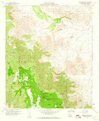
1959 Map of Monument Peak
USGS Topo · Published 1961About this map
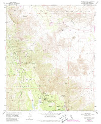
Oriflamme Mountain and the high ridges of the Sawtooth Range dominate this mid-century survey of the San Diego backcountry. The landscape reveals a complex overlap of land uses, from the Laguna Indian Reservation to the recreational facilities within the Cleveland National Forest, including the Sierra Club Guymon Lodge and Al Bahr Shrine Camp. The transition from the high meadows of Laguna Meadow and Big Laguna Lake down into the arid expanse of Anza-Borrego Desert State Park is clearly defined by the steep descents of Storm Canyon and Oriflamme Canyon. Cultural markers of earlier eras remain visible through the Old Overland Stage Route in the northeast and the Noble Mine to the southwest. The presence of the USAF Sta Mt Laguna near Monument Peak highlights the region's Cold War era strategic importance atop the high crests.
Find a feature on this map
49 named features on this map. Tap any name to fly to it.
Don’t see what you’re looking for? This feature index may not catch every label — zoom into the map to look around manually.
Map Details
Editions of this 1959 Monument Peak Map
6 editions found
Other maps of this area

1903 · Cuyamaca
USGS Topo · 1:125,000

1903 · Ramona
USGS Topo · 1:125,000

1904 · Southern California Sheet No. 2
USGS Topo · 1:250,000

1931 · Vallecito
USGS Topo · 1:125,000

1931 · Carrizo
USGS Topo · 1:125,000

1939 · Santa Ysabel
USGS Topo · 1:62,500

1939 · Borrego
USGS Topo · 1:62,500

1942 · Borego
USGS Topo · 1:62,500

1942 · Cuyapaipe
USGS Topo · 1:62,500

1942 · Cuyamaca Peak
USGS Topo · 1:62,500