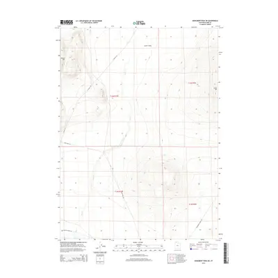
2014 Map of Monument Peak SW
USGS Topo · Published 2014About this map
Curlew Valley dominates this arid landscape in the northern reaches of the Great Basin, where the drainage of Deep Cr carves a path through the high desert terrain. The map reveals a land defined by historical transportation and natural barriers, anchored by the Wildcat Hills in the northwest and Cedar Hill to the east. A notable artifact of western expansion is the Old Railroad Grade Rd running along the southern margin, marking the path of the original Transcontinental Railroad corridor across the salt flats. This 2014 survey documents the sparse road network that persists today, including Locomotive Springs Rd and Deep Creek Rd, which provide access through this remote section of Box Elder County near the Idaho border.
Find a feature on this map
12 named features on this map. Tap any name to fly to it.
Don’t see what you’re looking for? This feature index may not catch every label — zoom into the map to look around manually.
Map Details
Editions of this 2014 Monument Peak SW Map
This is the sole edition of this map. No revisions or reprints were ever made.
Other maps of this area

1954 · Brigham City
USGS Topo · 1:250,000

1958 · Brigham City
USGS Topo · 1:250,000

1959 · Kelton Pass
USGS Topo · 1:62,500

1962 · Brigham City
USGS Topo · 1:250,000

1968 · Monument Point
USGS Topo · 1:24,000

1968 · Monument Peak NW
USGS Topo · 1:24,000

1968 · Monument Peak SW
USGS Topo · 1:24,000

1968 · Monument Peak
USGS Topo · 1:24,000

1968 · Monument Peak NE
USGS Topo · 1:24,000

1969 · Locomotive Springs
USGS Topo · 1:24,000