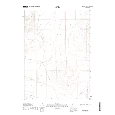
2023 Map of Monument Peak SW
USGS Topo · Published 2023About this map
Curlew Valley dominates the southern expanse of this landscape, where the wide basin meets the rising slopes of the Wildcat Hills. The map documents a sparsely populated corner of Box Elder County, defined primarily by its drainage patterns and historical transportation corridors. The course of Deep Creek winds through the valley floor, south of where Deep Creek Rd and E Wildcat Rd intersect. A significant archaeological and historical marker is found in the southwest corner with Old Railroad Grade Rd, tracing the path of the original transcontinental rail route across the northern reaches of the Great Salt Lake desert. Modern access is maintained via Locomotive Springs Rd, which connects this remote high-desert terrain to the surrounding ranching and conservation lands.
Find a feature on this map
7 named features on this map. Tap any name to fly to it.
Don’t see what you’re looking for? This feature index may not catch every label — zoom into the map to look around manually.
Map Details
Editions of this 2023 Monument Peak SW Map
This is the sole edition of this map. No revisions or reprints were ever made.
Other maps of this area

1954 · Brigham City
USGS Topo · 1:250,000

1958 · Brigham City
USGS Topo · 1:250,000

1959 · Kelton Pass
USGS Topo · 1:62,500

1962 · Brigham City
USGS Topo · 1:250,000

1968 · Monument Point
USGS Topo · 1:24,000

1968 · Monument Peak NW
USGS Topo · 1:24,000

1968 · Monument Peak SW
USGS Topo · 1:24,000

1968 · Monument Peak
USGS Topo · 1:24,000

1968 · Monument Peak NE
USGS Topo · 1:24,000

1969 · Locomotive Springs
USGS Topo · 1:24,000