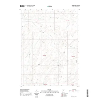
2017 Map of Monument Ridge
USGS Topo · Published 2017About this map
Monument Ridge stands as the central landmark of this high-desert landscape in Sweetwater County, where the hydrological divide of the Continental Divide dictates the flow of seasonal drainages. The topography is defined by a series of deep cuts, most notably LaFonte Canyon, Johnson Canyon, and the sheer walls of Box Canyon in the northwest. These landforms reveal the erosional patterns of a high-altitude environment where water is a scarce and precious resource, evidenced by the named Minnie Spring.
Find a feature on this map
18 named features on this map. Tap any name to fly to it.
Don’t see what you’re looking for? This feature index may not catch every label — zoom into the map to look around manually.
Map Details
Editions of this 2017 Monument Ridge Map
This is the sole edition of this map. No revisions or reprints were ever made.
Other maps of this area

1954 · Rock Springs
USGS Topo · 1:250,000

1955 · Lander
USGS Topo · 1:250,000

1958 · Lander
USGS Topo · 1:250,000

1958 · Rock Springs
USGS Topo · 1:250,000

1958 · Essex Mountain
USGS Topo · 1:62,500

1958 · Boars Tusk
USGS Topo · 1:62,500

1958 · Freighter Gap
USGS Topo · 1:62,500

1958 · Superior
USGS Topo · 1:62,500

1961 · Lander
USGS Topo · 1:250,000

1962 · Rock Springs
USGS Topo · 1:250,000