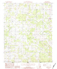
1983 Map of Moody
USGS Topo · Published 1984About this map
Moody and Lebo anchor this 1983 topographic survey of the Missouri-Arkansas borderlands, where the landscape is defined by the winding South Fork Spring River and its numerous tributaries. The area's social fabric is visible through its rural congregations and burial grounds, including China Union Ch, Mt Zion Ch, and the McElmerry Cem. This map details a region of intricate drainage patterns, where local life follows the contours of Newberry Hollow, Cabin Hollow, and Hay Hollow. The terrain rises toward Turkeypen Ridge in the southeast, while numerous named water sources like Cherry Spring, Lapp Spring, and Gladden Spring dot the limestone-rich topography. The survey clearly delineates the Missouri Arkansas state line, illustrating the road network of Benton township as it connects these remote Ozark communities during the early 1980s.
Find a feature on this map
26 named features on this map. Tap any name to fly to it.
Don’t see what you’re looking for? This feature index may not catch every label — zoom into the map to look around manually.
Map Details
Editions of this 1983 Moody Map
This is the sole edition of this map. No revisions or reprints were ever made.
Other maps of this area

1890 · Mountain Home
USGS Topo · 1:125,000

1891 · Mountain Home
USGS Topo · 1:125,000

1894 · Mountain Home
USGS Topo · 1:125,000

1938 · West Plains
USGS Topo · 1:24,000

1940 · West Plains
USGS Topo · 1:24,000

1944 · West Plains
USGS Topo · 1:62,500

1944 · Cureall
USGS Topo · 1:62,500

1945 · Harrison
USGS Topo · 1:250,000

1946 · West Plains
USGS Topo · 1:62,500

1946 · Cureall
USGS Topo · 1:62,500