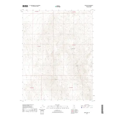
2018 Map of Moody Peak
USGS Topo · Published 2018About this map
Moody Peak dominates the central high ground of this landscape within the southern reaches of the Pancake Range. The terrain is defined by its verticality and the vital presence of isolated water sources in a high-elevation desert environment. A network of specific water points, including Buck Spring, Collins Spring, and Mahogany Spring, indicates the essential hydrology that supported ranching and movement through these canyons. To the east, Moody Mtn stands as a significant landmark, while Moody Spring provides a critical anchor at the southern end of the quadrangle. This 2018 survey detail provides a modern baseline for the land as it remains managed by the Bureau of Land Management, showing the enduring importance of these named springs to the region's geography.
Find a feature on this map
7 named features on this map. Tap any name to fly to it.
Don’t see what you’re looking for? This feature index may not catch every label — zoom into the map to look around manually.
Map Details
Editions of this 2018 Moody Peak Map
This is the sole edition of this map. No revisions or reprints were ever made.
Other maps of this area

1926 · Roberts Mountains
USGS Topo · 1:250,000

1929 · Roberts Mountains
USGS Topo · 1:250,000

1955 · Millett
USGS Topo · 1:250,000

1956 · Cockalorum Wash
USGS Topo · 1:62,500

1956 · Lund
USGS Topo · 1:250,000

1956 · Ely
USGS Topo · 1:250,000

1956 · Tonopah
USGS Topo · 1:250,000

1959 · Ely
USGS Topo · 1:250,000

1959 · Tonopah
USGS Topo · 1:250,000

1959 · Millett
USGS Topo · 1:250,000