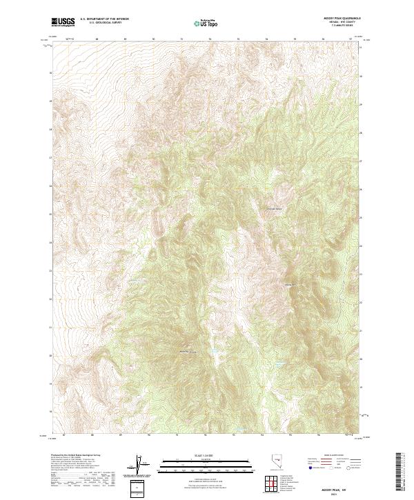
2021 Map of Moody Peak
USGS Topo · Published 2021About this map
Moody Peak and the high ridges of the Pancake Range dominate this interior Nevada landscape within Nye County. The area is defined by its vertical relief and essential water sources, with several named springs serving as the primary landmarks in this high-desert environment. Topographic details trace the steep elevations around Moody Mtn, where the terrain drops into canyons containing Buck Spring and Collins Spring. The mapping of these water points, including Mahogany Spring and Moody Spring, reflects their historical importance for survival and livestock in a region with few permanent settlements. Surveyed by the U.S. Geological Survey using modern imagery and elevation datasets, this map provides a clear record of public land boundaries and the natural drainage patterns of the Great Basin.
Find a feature on this map
13 named features on this map. Tap any name to fly to it.
Don’t see what you’re looking for? This feature index may not catch every label — zoom into the map to look around manually.
Map Details
Editions of this 2021 Moody Peak Map
This is the sole edition of this map. No revisions or reprints were ever made.
Other maps of this area

1926 · Roberts Mountains
USGS Topo · 1:250,000

1929 · Roberts Mountains
USGS Topo · 1:250,000

1955 · Millett
USGS Topo · 1:250,000

1956 · Cockalorum Wash
USGS Topo · 1:62,500

1956 · Lund
USGS Topo · 1:250,000

1956 · Ely
USGS Topo · 1:250,000

1956 · Tonopah
USGS Topo · 1:250,000

1959 · Ely
USGS Topo · 1:250,000

1959 · Tonopah
USGS Topo · 1:250,000

1959 · Millett
USGS Topo · 1:250,000