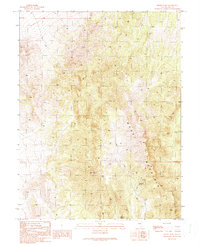
1990 Map of Moody Peak
USGS Topo · Published 1990About this map
Collins Hotel sits as a solitary man-made landmark at the foot of the high ridges in this section of the Nevada high desert. The map area is dominated by the steep, rising topography of Moody Mountain, culminating at the prominent Moody Peak. This remote landscape, surveyed near the end of the twentieth century, reveals a sparse network of 4wd tracks that represent the only reliable passage through the high-elevation terrain. Water sources are critical points on this map, with several named locations such as Mahogany Spring, Moody Spring, and a designated Well providing life-sustaining stops in an otherwise arid environment. The presence of the Moody Mtn mine site indicates a history of mineral exploration or extraction occurring alongside these essential water features and historical structures.
Find a feature on this map
12 named features on this map. Tap any name to fly to it.
Don’t see what you’re looking for? This feature index may not catch every label — zoom into the map to look around manually.
Map Details
Editions of this 1990 Moody Peak Map
This is the sole edition of this map. No revisions or reprints were ever made.
Other maps of this area

1926 · Roberts Mountains
USGS Topo · 1:250,000

1929 · Roberts Mountains
USGS Topo · 1:250,000

1955 · Millett
USGS Topo · 1:250,000

1956 · Cockalorum Wash
USGS Topo · 1:62,500

1956 · Lund
USGS Topo · 1:250,000

1956 · Ely
USGS Topo · 1:250,000

1956 · Tonopah
USGS Topo · 1:250,000

1959 · Ely
USGS Topo · 1:250,000

1959 · Tonopah
USGS Topo · 1:250,000

1959 · Millett
USGS Topo · 1:250,000