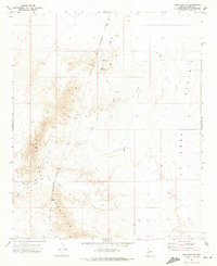
1971 Map of Moon Mtn SE
USGS Topo · Published 1973About this map
The Dome Rock Mountains dominate the western portion of this desert landscape, where the rugged topography meets the expansive La Posa Plain. This early 1970s survey captures a transition zone of mineral exploration and historical desert passage, marked clearly by the Colorado River Indian Reservation Boundary running north to south through the terrain. Evidence of prospecting is scattered throughout the hills, including the Valenzuela Mine and various Prospects and Drill Holes located near Copper Peak.
Find a feature on this map
13 named features on this map. Tap any name to fly to it.
Don’t see what you’re looking for? This feature index may not catch every label — zoom into the map to look around manually.
Map Details
Editions of this 1971 Moon Mtn SE Map
2 editions found
Other maps of this area

1930 · Linskey
USGS Topo · 1:62,500

1931 · Moon Mtn
USGS Topo · 1:62,500

1932 · Moon Mtn
USGS Topo · 1:62,500

1933 · Cunningham Mtn
USGS Topo · 1:48,000

1940 · Dome Rock Mts
USGS Topo · 1:62,500

1942 · Blythe
USGS Topo · 1:250,000

1942 · MOON MTN
USGS Topo · 1:62,500

1954 · Salton Sea
USGS Topo · 1:250,000

1955 · Salton Sea
USGS Topo · 1:250,000
1955 · Moon Mtn
USGS Topo · 1:24,000