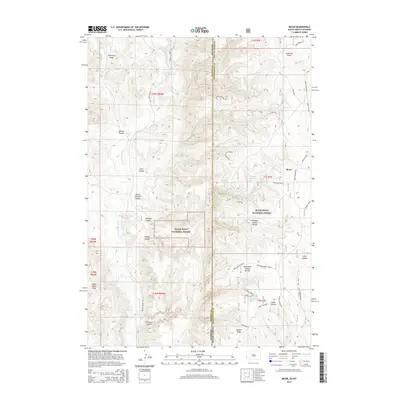
2015 Map of Moon
USGS Topo · Published 2015About this map
Black Hills National Forest land dominates this high-altitude landscape along the South Dakota and Wyoming state line. The settlement of Moon sits near the eastern edge, serving as a landmark in a terrain defined by complex drainage networks and named canyons. The water management of the era is evident through several localized water sources, including the Jordon Reservoir, Martin Thompson Reservoir, and Dolores Number 1 Reservoir, which supported ranching or forest operations. Topographical prominence is found at Summit Ridge and along the Thomson-Kinney Divide, which separates the deep cuts of Kinney Canyon and Thomson Canyon. A network of forest and local roads, such as Beaver Creek Rd and Boles Canyon Rd, provide access through the dense topography of the Stockade Beaver Cr valley and surrounding draws.
Find a feature on this map
50 named features on this map. Tap any name to fly to it.
Don’t see what you’re looking for? This feature index may not catch every label — zoom into the map to look around manually.
Map Details
Editions of this 2015 Moon Map
This is the sole edition of this map. No revisions or reprints were ever made.
Other maps of this area

1894 · Deadwood
USGS Topo · 1:125,000

1896 · Harney Peak
USGS Topo · 1:125,000

1898 · Sundance
USGS Topo · 1:125,000

1899 · Newcastle
USGS Topo · 1:125,000

1901 · Harney Peak
USGS Topo · 1:125,000

1901 · Deadwood
USGS Topo · 1:125,000

1901 · Newcastle
USGS Topo · 1:125,000

1902 · Sundance
USGS Topo · 1:125,000

1916 · Deadwood
USGS Topo · 1:125,000

1951 · Newcastle
USGS Topo · 1:24,000