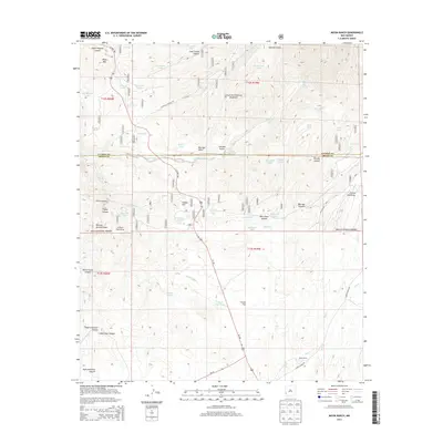
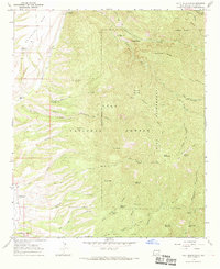
2013 Map of Moon Ranch
USGS Topo · Published 2013About this map
Gila National Forest encompasses the high desert terrain of this area, where water management is the primary signature of human activity. The landscape is characterized by a dense network of water tanks and canyons, such as Goat Corral Canyon and Mineral Spring Canyon, which serve the livestock needs of the namesake Moon Ranch located along Moon Ranch Rd. This 2013 survey illustrates how topography dictates movement and land use, with US Hwy 180 cutting through the center to connect the high elevations of Black Mtn in the north to the lower reaches of Pine Cr in the south.
Find a feature on this map
68 named features on this map. Tap any name to fly to it.
Don’t see what you’re looking for? This feature index may not catch every label — zoom into the map to look around manually.
Map Details
Editions of this 2013 Moon Ranch Map
This is the sole edition of this map. No revisions or reprints were ever made.
Other maps of this area

1910 · Mogollon
USGS Topo · 1:125,000

1912 · Mogollon
USGS Topo · 1:125,000

1954 · Clifton
USGS Topo · 1:250,000

1957 · Clifton
USGS Topo · 1:250,000

1958 · Clifton
USGS Topo · 1:250,000

1962 · Clifton
USGS Topo · 1:250,000
1965 · Mule Creek
USGS Topo · 1:24,000
1965 · Wilson Mountain
USGS Topo · 1:24,000
1965 · Rice Ranch
USGS Topo · 1:24,000
1965 · Holt Mountain
USGS Topo · 1:24,000