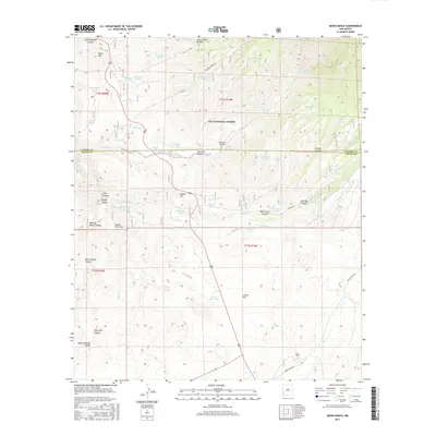
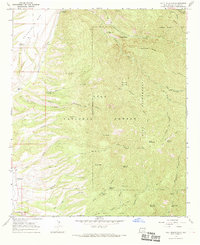
2017 Map of Moon Ranch
USGS Topo · Published 2017About this map
Gila National Forest encompasses much of this high desert terrain in Grant County, where the landscape is defined by deep drainages like South Dugway Canyon and Eliot Canyon. The cattle-ranching heritage of the region is evident in the dense network of water features, including Big Dry Box Spring and numerous tanks such as Horseshoe Tank, Mud Tank, and One Horn Tank. These vital water sources supported the livestock industry throughout the rugged basins between Black Mtn and Soldier Hill.
Find a feature on this map
102 named features on this map. Tap any name to fly to it.
Don’t see what you’re looking for? This feature index may not catch every label — zoom into the map to look around manually.
Map Details
Editions of this 2017 Moon Ranch Map
This is the sole edition of this map. No revisions or reprints were ever made.
Other maps of this area

1910 · Mogollon
USGS Topo · 1:125,000

1912 · Mogollon
USGS Topo · 1:125,000

1954 · Clifton
USGS Topo · 1:250,000

1957 · Clifton
USGS Topo · 1:250,000

1958 · Clifton
USGS Topo · 1:250,000

1962 · Clifton
USGS Topo · 1:250,000
1965 · Mule Creek
USGS Topo · 1:24,000
1965 · Wilson Mountain
USGS Topo · 1:24,000
1965 · Rice Ranch
USGS Topo · 1:24,000
1965 · Holt Mountain
USGS Topo · 1:24,000