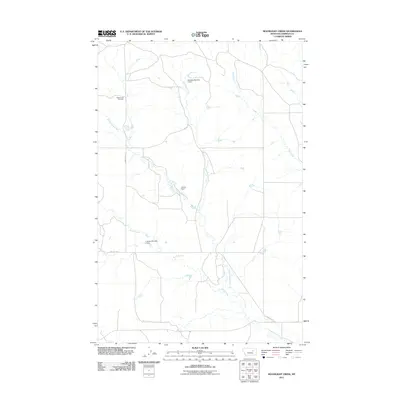
2011 Map of Moonlight Creek
USGS Topo · Published 2011About this map
The Butte Creek Cemetery sits near the headwaters of the Missouri River's northern drainage system, anchoring a sparsely populated landscape of Garfield County. This 2011 survey illustrates a region defined by its water management and grazing infrastructure, characterized by numerous small reservoirs like Larson Dam, Weeding Number 2 Dam, and J Larson Number 2 Dam. These artificial ponds are critical nodes along the seasonal waterways of Smoky Butte Creek and Moonlight Creek.
Find a feature on this map
10 named features on this map. Tap any name to fly to it.
Don’t see what you’re looking for? This feature index may not catch every label — zoom into the map to look around manually.
Map Details
Editions of this 2011 Moonlight Creek Map
This is the sole edition of this map. No revisions or reprints were ever made.
Other maps of this area

1954 · Jordan
USGS Topo · 1:250,000

1956 · Jordan
USGS Topo · 1:250,000

1958 · Jordan
USGS Topo · 1:250,000

1964 · Jordan
USGS Topo · 1:250,000

1971 · Hell Hollow
USGS Topo · 1:24,000

1971 · Trumbo Ranch
USGS Topo · 1:24,000

1971 · Chalk Butte
USGS Topo · 1:24,000

1978 · Fort Peck Lake West
USGS Topo · 1:100,000
1983 · Biscuit Butte
USGS Topo · 1:24,000

1983 · Steve Forks
USGS Topo · 1:24,000