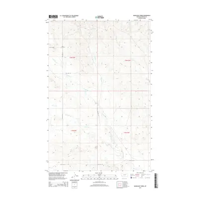
2014 Map of Moonlight Creek
USGS Topo · Published 2014About this map
Butte Creek Cem sits as a quiet landmark in the northwestern corner of this Garfield County landscape, marking the long-standing presence of ranching families in this part of Montana. The terrain is defined by a network of seasonal watercourses and drainage systems, most notably the winding path of Moonlight Cr and the broad Butts Coulee. These features shape the local movement and land use patterns, as evidenced by the primitive and secondary roads like Snow Creek Rd and Butte Creek Rd that follow the natural contours of the high plains. The area is also crossed by Smoky Butte Cr and Vail Cr, which cut through the open country. This 2014 survey by the U.S. Geological Survey details a sparsely populated ranching region where the primary infrastructure consists of remote county routes and state highway Mt-245.
Find a feature on this map
14 named features on this map. Tap any name to fly to it.
Don’t see what you’re looking for? This feature index may not catch every label — zoom into the map to look around manually.
Map Details
Editions of this 2014 Moonlight Creek Map
This is the sole edition of this map. No revisions or reprints were ever made.
Other maps of this area

1954 · Jordan
USGS Topo · 1:250,000

1956 · Jordan
USGS Topo · 1:250,000

1958 · Jordan
USGS Topo · 1:250,000

1964 · Jordan
USGS Topo · 1:250,000

1971 · Hell Hollow
USGS Topo · 1:24,000

1971 · Trumbo Ranch
USGS Topo · 1:24,000

1971 · Chalk Butte
USGS Topo · 1:24,000

1978 · Fort Peck Lake West
USGS Topo · 1:100,000
1983 · Biscuit Butte
USGS Topo · 1:24,000

1983 · Steve Forks
USGS Topo · 1:24,000