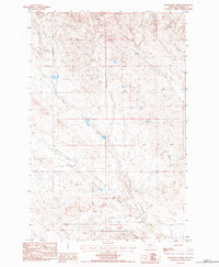
1983 Map of Moonlight Creek
USGS Topo · Published 1984About this map
Butte Creek Cem sits in the northwestern corner of this Garfield County landscape, marking a solitary point of record in a sparsely settled ranching region. The terrain is defined by a series of drainages, most notably Moonlight Creek and the meandering Butte Creek, which give way to the prominent elevation of Smoky Butte in the south. The presence of the Trumbo Ranch and a remote Landing Strip underscores the vast distances and specialized infrastructure required for life in this part of Montana during the early 1980s. A network of unimproved roads and trails connects scattered resources like Tanks and a Well, tracing the practical geography of livestock management across Butts Coulee and the basin of Smoky Butte Creek.
Find a feature on this map
11 named features on this map. Tap any name to fly to it.
Don’t see what you’re looking for? This feature index may not catch every label — zoom into the map to look around manually.
Map Details
Editions of this 1983 Moonlight Creek Map
This is the sole edition of this map. No revisions or reprints were ever made.
Other maps of this area

1954 · Jordan
USGS Topo · 1:250,000

1956 · Jordan
USGS Topo · 1:250,000

1958 · Jordan
USGS Topo · 1:250,000

1964 · Jordan
USGS Topo · 1:250,000

1971 · Hell Hollow
USGS Topo · 1:24,000

1971 · Trumbo Ranch
USGS Topo · 1:24,000

1971 · Chalk Butte
USGS Topo · 1:24,000

1978 · Fort Peck Lake West
USGS Topo · 1:100,000
1983 · Biscuit Butte
USGS Topo · 1:24,000

1983 · Steve Forks
USGS Topo · 1:24,000