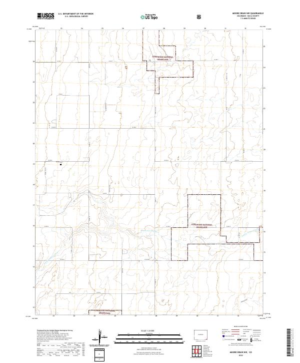
2022 Map of Moore Draw NW
USGS Topo · Published 2022About this map
Comanche National Grassland dominates this high plains landscape in Baca County, where the topography is defined by the gradual carving of the N Fork Cimarron River. The area is marked by a rigid grid of rural county roads, such as Co RD T and Co RD 38, which section off large swaths of range and prairie. A singular point of genealogical interest is the Rodley Cem located in the western portion of the quadrangle. The map also traces the winding course of Moore Draw as it cuts through the southeastern corner, illustrating the importance of these seasonal drainages in an arid ranching environment. The survey provides a clear view of the Public Land Survey System boundaries, including t32s r45w and t33s r44w, which have dictated the layout of the land since initial settlement.
Find a feature on this map
28 named features on this map. Tap any name to fly to it.
Don’t see what you’re looking for? This feature index may not catch every label — zoom into the map to look around manually.
Map Details
Editions of this 2022 Moore Draw NW Map
This is the sole edition of this map. No revisions or reprints were ever made.
Other maps of this area

1891 · Springfield
USGS Topo · 1:125,000

1892 · Vilas
USGS Topo · 1:125,000

1893 · Springfield
USGS Topo · 1:125,000

1955 · La Junta
USGS Topo · 1:250,000

1958 · La Junta
USGS Topo · 1:250,000

1968 · La Junta
USGS Topo · 1:250,000

1978 · Walsh SE
USGS Topo · 1:24,000
1978 · Moore Draw SW
USGS Topo · 1:24,000

1978 · Moore Draw NE
USGS Topo · 1:24,000

1978 · Campo NE
USGS Topo · 1:24,000