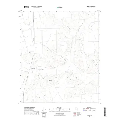
2019 Map of Moore Hill
USGS Topo · Published 2019About this map
Moore Hill rises above a complex network of seasonal watercourses in this Reagan County landscape, where the drainage patterns of the Edwards Plateau are clearly defined. The terrain is deeply etched by numerous named draws, including Centralia Draw, Red House Draw, and the extensive West Fork North Creek Draw, which illustrate the region's hydrologic character. Transportation is primarily facilitated by Ranch Rd 33, providing access to the vast ranch lands of West Texas.
Find a feature on this map
14 named features on this map. Tap any name to fly to it.
Don’t see what you’re looking for? This feature index may not catch every label — zoom into the map to look around manually.
Map Details
Editions of this 2019 Moore Hill Map
This is the sole edition of this map. No revisions or reprints were ever made.
Other maps of this area

1928 · Rankin
USGS Topo · 1:125,000

1954 · San Angelo
USGS Topo · 1:250,000

1958 · San Angelo
USGS Topo · 1:250,000

1965 · San Angelo
USGS Topo · 1:250,000

1970 · South Mustang Draw SE
USGS Topo · 1:24,000

1970 · South Mustang Draw NE
USGS Topo · 1:24,000

1970 · Moore Hill
USGS Topo · 1:24,000

1970 · Gardener Draw
USGS Topo · 1:24,000
1970 · Divide Draw
USGS Topo · 1:24,000

1970 · Stiles
USGS Topo · 1:24,000