
1970 Map of Stiles
USGS Topo · Published 1973About this map
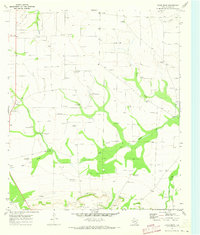
The Stiles Oil Field dominates this West Texas landscape, defined by a dense network of extraction infrastructure including a Pumping Sta, storage tanks, and a major Pipeline. At the heart of the region sits the settlement of Stiles, once a bustling center that by the time of this 1968 aerial survey served as a focal point for local history at the Stiles Cem. The terrain is etched by seasonal drainage patterns like Centralia Draw, High Lonesome Draw, and Gardener Draw, which slice through the plateau. Small-scale rural life persists near Hughes and around the Community Ch, while numerous gravel pits across the map highlight the industrial activity supporting road and oil field maintenance in Reagan County. The map provides a clear look at the spatial relationship between natural arroyos and the intensive industrial footprint of the Texas oil industry.
Find a feature on this map
16 named features on this map. Tap any name to fly to it.
Don’t see what you’re looking for? This feature index may not catch every label — zoom into the map to look around manually.
Map Details
Editions of this 1970 Stiles Map
This is the sole edition of this map. No revisions or reprints were ever made.
Other maps of this area

1928 · Rankin
USGS Topo · 1:125,000

1954 · San Angelo
USGS Topo · 1:250,000

1958 · San Angelo
USGS Topo · 1:250,000

1965 · San Angelo
USGS Topo · 1:250,000

1970 · Stiles NW
USGS Topo · 1:24,000

1970 · Moore Hill
USGS Topo · 1:24,000

1970 · Garrison Draw
USGS Topo · 1:24,000

1970 · Gardener Draw
USGS Topo · 1:24,000
1970 · Divide Draw
USGS Topo · 1:24,000

1973 · Saint Lawrence SE
USGS Topo · 1:24,000