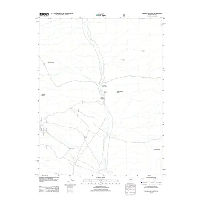
2012 Map of Moores Station
USGS Topo · Published 2012About this map
Moores Station serves as the focal point of this arid Nye County landscape, situated where the Moores Station Wash cuts through the high desert. The map reveals a complex network of forest service and local roads, such as roads 812 and 822, which provide access to the surrounding geological formations. The terrain is characterized by numerous landforms including the Confusion Hills and Cruiser Point to the northeast, and the Moores Station Buttes overlooking the station itself.
Find a feature on this map
23 named features on this map. Tap any name to fly to it.
Don’t see what you’re looking for? This feature index may not catch every label — zoom into the map to look around manually.
Map Details
Editions of this 2012 Moores Station Map
This is the sole edition of this map. No revisions or reprints were ever made.
Other maps of this area

1956 · Tonopah
USGS Topo · 1:250,000

1959 · Tonopah
USGS Topo · 1:250,000

1962 · Tonopah
USGS Topo · 1:250,000

1967 · Moores Station
USGS Topo · 1:62,500

1967 · Moores Station SE
USGS Topo · 1:24,000

1967 · Moores Station
USGS Topo · 1:24,000

1967 · Chaos Creek
USGS Topo · 1:24,000

1967 · Morey Peak
USGS Topo · 1:24,000
1967 · Moores Station SW
USGS Topo · 1:24,000

1968 · Morey Peak
USGS Topo · 1:62,500