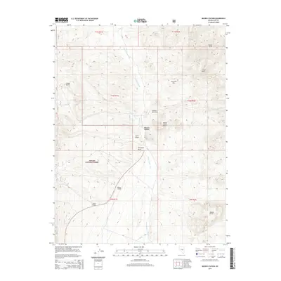
2014 Map of Moores Station
USGS Topo · Published 2014About this map
Moores Station serves as the focal point of this arid Nye County landscape, situated near the intersection of several prominent landforms including the Moores Station Buttes and the winding Moores Station Wash. The topography is defined by significant relief, with the Needle Range and Confusion Hills marking the eastern and northern reaches. To the west, the boundaries of the Toiyabe National Forest encompass numerous drainage systems like Morey Canyon and South Canyon. Notable landmarks such as Petroglyph Butte suggest the deep historical and cultural layers of this Great Basin environment. Small seasonal watercourses, including the vividly named Orange Lichen Cr, thread through the basins between high points like Cruiser Point and Shingle Buttes.
Find a feature on this map
21 named features on this map. Tap any name to fly to it.
Don’t see what you’re looking for? This feature index may not catch every label — zoom into the map to look around manually.
Map Details
Editions of this 2014 Moores Station Map
This is the sole edition of this map. No revisions or reprints were ever made.
Other maps of this area

1956 · Tonopah
USGS Topo · 1:250,000

1959 · Tonopah
USGS Topo · 1:250,000

1962 · Tonopah
USGS Topo · 1:250,000

1967 · Moores Station
USGS Topo · 1:62,500

1967 · Moores Station SE
USGS Topo · 1:24,000

1967 · Moores Station
USGS Topo · 1:24,000

1967 · Chaos Creek
USGS Topo · 1:24,000

1967 · Morey Peak
USGS Topo · 1:24,000
1967 · Moores Station SW
USGS Topo · 1:24,000

1968 · Morey Peak
USGS Topo · 1:62,500