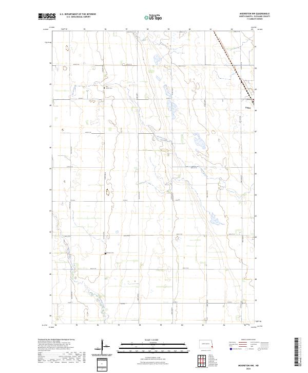
2024 Map of Mooreton NW
USGS Topo · Published 2024About this map
Pitcairn Creek and Antelope Creek meander through this section of the Red River Valley, defining the low-lying hydrology of southeastern North Dakota. The landscape is dominated by a precise section-line road grid, including Co Rd 4, Co Rd 6, and Co Rd 8, which organize the agricultural reaches of Richland County. The small community of Colfax sits on the eastern edge of the survey, serving as a local hub near the North Country National Scenic Trail as it cuts diagonally across the township lines. For those researching family history in the region, the map identifies two significant burial sites: Zion United Cem in the northwest and Stearns Cem further south. The drainage patterns of the creeks and the placement of these rural cemeteries provide clear markers of the long-standing settlement patterns in this prairie environment.
Find a feature on this map
26 named features on this map. Tap any name to fly to it.
Don’t see what you’re looking for? This feature index may not catch every label — zoom into the map to look around manually.
Map Details
Editions of this 2024 Mooreton NW Map
This is the sole edition of this map. No revisions or reprints were ever made.
Other maps of this area

1895 · Fargo
USGS Topo · 1:125,000

1895 · Casselton
USGS Topo · 1:125,000

1897 · Fargo
USGS Topo · 1:125,000

1897 · Casselton
USGS Topo · 1:125,000

1904 · Wahpeton
USGS Topo · 1:125,000

1907 · Wyndmere
USGS Topo · 1:125,000

1953 · Fargo
USGS Topo · 1:250,000

1956 · Fargo
USGS Topo · 1:250,000

1959 · Wyndmere NE
USGS Topo · 1:24,000

1959 · Mooreton NW
USGS Topo · 1:24,000