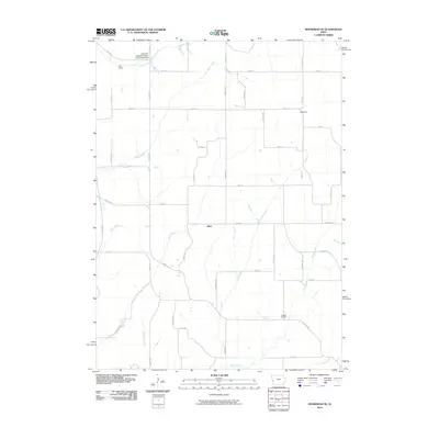
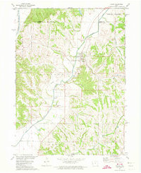
2010 Map of Moorhead SE
USGS Topo · Published 2010About this map
Allen sits at the heart of this Harrison County landscape, where the drainage patterns of the Loess Hills define the local geography. The area is characterized by a dense network of waterways, including Willow Creek, Stowe Creek, and Elk Creek, which carve through the terrain and influence the placement of rural roads and homesteads. The transition between agricultural use and recreation is evident in the presence of the Loess Hills Hideaway Cabins and Campground in the northwest, providing a specific focal point for the region's unique landforms. For those looking for historical markers, Hodges Cemetery remains a stable landmark in the southeastern portion of the map, while the small settlement of Olympus appears to the north. The survey also traces several local trails, such as Easton Trl and Nash Trl, which connect these isolated points across the creek-cut topography.
Find a feature on this map
52 named features on this map. Tap any name to fly to it.
Don’t see what you’re looking for? This feature index may not catch every label — zoom into the map to look around manually.
Map Details
Editions of this 2010 Moorhead SE Map
This is the sole edition of this map. No revisions or reprints were ever made.
Other maps of this area

1954 · Omaha
USGS Topo · 1:250,000

1957 · Omaha
USGS Topo · 1:250,000

1958 · Omaha
USGS Topo · 1:250,000

1970 · Logan
USGS Topo · 1:24,000
1970 · Missouri Valley NW
USGS Topo · 1:24,000

1971 · Moorhead SE
USGS Topo · 1:24,000

1971 · Dunlap SW
USGS Topo · 1:24,000
1971 · Moorhead
USGS Topo · 1:24,000
1971 · Dunlap NW
USGS Topo · 1:24,000
1971 · Pisgah
USGS Topo · 1:24,000