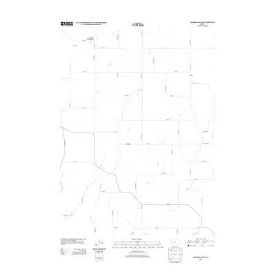
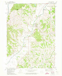
2013 Map of Moorhead SE
USGS Topo · Published 2013About this map
Allen sits at the center of this rural Harrison County landscape, where the drainage of the Loess Hills shapes the local road and settlement patterns. The topography is defined by numerous winding watercourses, including Allen Cr, Elk Cr, and Hoffman Cr, which carve through the terrain. In the northern reaches, the Loess Hills Hideaway Cabins and Campground near Hall Creek points to the area's role as a recreational destination within this distinct geological formation. The grid of country roads, such as Co Hwy L16 and Macy Ln, provides access to the small community of Olympus and various farmstead sites. This 2013 survey illustrates the enduring agricultural character of the region, showing how contemporary land use continues to follow the natural contours established by Stowe Cr and Steer Cr.
Find a feature on this map
61 named features on this map. Tap any name to fly to it.
Don’t see what you’re looking for? This feature index may not catch every label — zoom into the map to look around manually.
Map Details
Editions of this 2013 Moorhead SE Map
This is the sole edition of this map. No revisions or reprints were ever made.
Other maps of this area

1954 · Omaha
USGS Topo · 1:250,000

1957 · Omaha
USGS Topo · 1:250,000

1958 · Omaha
USGS Topo · 1:250,000

1970 · Logan
USGS Topo · 1:24,000
1970 · Missouri Valley NW
USGS Topo · 1:24,000

1971 · Moorhead SE
USGS Topo · 1:24,000

1971 · Dunlap SW
USGS Topo · 1:24,000
1971 · Moorhead
USGS Topo · 1:24,000
1971 · Dunlap NW
USGS Topo · 1:24,000
1971 · Pisgah
USGS Topo · 1:24,000