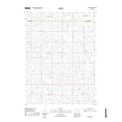
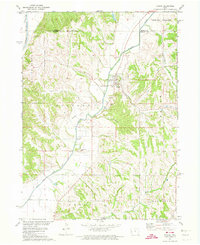
2018 Map of Moorhead SE
USGS Topo · Published 2018About this map
Hodges Cem sits amidst the drainage networks of the Loess Hills region, a solitary landmark in this rural landscape at the border of Monona and Harrison counties. The terrain is defined by a dense system of waterways, including Allen Cr, Willow Cr, and Elk Cr, which carve through the land in a complex pattern of ridges and valleys. This 2018 survey illustrates a highly developed grid of secondary roads and local trails, such as Co Hwy L16 and Nash Trl, which navigate the elevation changes to connect remote farmsteads and agricultural plots. The distribution of these routes, from Sequoia Ave to Laredo Ave, reveals how the township lines of T81N and T82N were adapted to the challenging topography of western Iowa. Researchers can trace the path of numerous small tributaries like Hall Cr and Stowe Cr as they feed into the larger creek systems that have shaped this farming community.
Find a feature on this map
61 named features on this map. Tap any name to fly to it.
Don’t see what you’re looking for? This feature index may not catch every label — zoom into the map to look around manually.
Map Details
Editions of this 2018 Moorhead SE Map
This is the sole edition of this map. No revisions or reprints were ever made.
Other maps of this area

1954 · Omaha
USGS Topo · 1:250,000

1957 · Omaha
USGS Topo · 1:250,000

1958 · Omaha
USGS Topo · 1:250,000

1970 · Logan
USGS Topo · 1:24,000
1970 · Missouri Valley NW
USGS Topo · 1:24,000

1971 · Moorhead SE
USGS Topo · 1:24,000

1971 · Dunlap SW
USGS Topo · 1:24,000
1971 · Moorhead
USGS Topo · 1:24,000
1971 · Dunlap NW
USGS Topo · 1:24,000
1971 · Pisgah
USGS Topo · 1:24,000