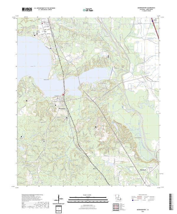
2024 Map of Mooringsport
USGS Topo · Published 2024About this map
The northern reaches of Caddo Parish are defined by the winding waters of Caddo Lake and the low-lying expanse of the Soda Lake Bed. In this modern topographic study, the settlement of Mooringsport serves as a central hub, flanked by the residential grids of Oil City to the north and Blanchard to the southeast. The landscape is dotted with small-scale family and community landmarks that reflect the deep-rooted local heritage, including the Mooring Family Cem and the Stewart-Bonham Cem. The complex hydrography of the region is evident in the network of waterways such as Twelvemile Bayou and Black Bayou, which carve through the terrain near Stormy Point. Notable infrastructure such as the Belcher Airpatch and Williamson Pkwy illustrate the modern connectivity of this rural Louisiana landscape, while numerous country churches like Saint Johns Baptist Church remain focal points for the community.
Find a feature on this map
103 named features on this map. Tap any name to fly to it.
Don’t see what you’re looking for? This feature index may not catch every label — zoom into the map to look around manually.
Map Details
Editions of this 2024 Mooringsport Map
This is the sole edition of this map. No revisions or reprints were ever made.
Other maps of this area

1932 · Shreveport SE
USGS Topo · 1:31,680

1932 · Hosston SW
USGS Topo · 1:31,680

1932 · Hosston SE
USGS Topo · 1:31,680

1932 · Shreveport NE
USGS Topo · 1:31,680

1944 · Kildare
USGS Topo · 1:62,500

1944 · Caddo Lake
USGS Topo · 1:62,500

1946 · Caddo Lake
USGS Topo · 1:62,500

1948 · Kildare
USGS Topo · 1:62,500

1948 · Mooringsport
USGS Topo · 1:62,500

1948 · Vivian
USGS Topo · 1:62,500