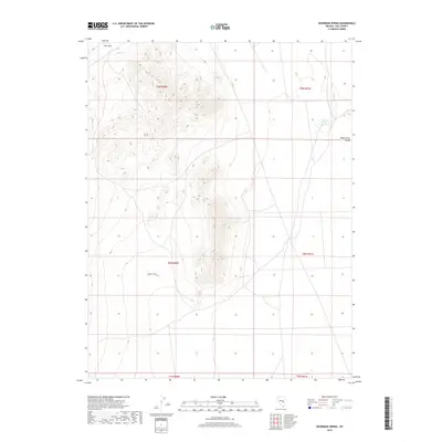
2018 Map of Moorman Spring
USGS Topo · Published 2018About this map
Moorman Spring serves as a vital water source in the high desert of Nye County, positioned along the western edge of the White River Valley. This 2018 survey illustrates a stark Great Basin landscape defined by significant topographic relief between the valley floor and the surrounding upland features. Large geographic depressions known as The Cove and Lower Cove mark the western portion of the quadrangle, illustrating the complex erosional patterns of the region. The map provides clear documentation of the Public Land Survey System grids, specifically crossing through T9N, T8N, and T7N, which is essential for land tenure research and identifying historical grazing or water rights in this arid environment.
Find a feature on this map
10 named features on this map. Tap any name to fly to it.
Don’t see what you’re looking for? This feature index may not catch every label — zoom into the map to look around manually.
Map Details
Editions of this 2018 Moorman Spring Map
This is the sole edition of this map. No revisions or reprints were ever made.
Other maps of this area

1956 · Lund
USGS Topo · 1:250,000

1960 · Lund
USGS Topo · 1:250,000

1964 · Currant
USGS Topo · 1:62,500

1964 · Forest Home
USGS Topo · 1:62,500

1969 · Sunnyside
USGS Topo · 1:24,000

1969 · Moorman Spring SE
USGS Topo · 1:24,000

1969 · Sunnyside NW
USGS Topo · 1:24,000

1969 · Moorman Spring NW
USGS Topo · 1:24,000

1969 · Moorman Spring
USGS Topo · 1:24,000

1969 · Moorman Spring NE
USGS Topo · 1:24,000