
1927 Map of Moose Bog
USGS Topo · Published 1927About this map
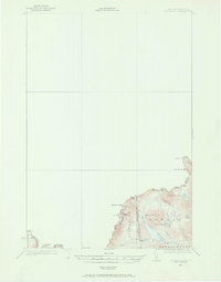
The international border between Canada and the United States defines the northern edge of this 1927 survey, where Quebec meets the northernmost reaches of Oxford County. This is a landscape dominated by the high-elevation drainage systems of the Third East Branch Magalloway River, centered around the namesake Moose Bog and Moose Brook. Settlement is extremely sparse in this timber-dense region, with the Bowman Farm serving as a rare named landmark of human activity amidst the terrain. The map traces the complex boundary lines where Pittsburg, New Hampshire converges with Maine and Canada, following the heights of Marble Mtn and Saddle Hill. For those studying the early 20th-century hydrology of the North Woods, the detailed survey of Bowman Ponds, Barker Pond, and Mountain Pond provides a precise record of the area's natural state before modern developments.
Find a feature on this map
19 named features on this map. Tap any name to fly to it.
Don’t see what you’re looking for? This feature index may not catch every label — zoom into the map to look around manually.
Map Details
Editions of this 1927 Moose Bog Map
3 editions found
Other maps of this area

1925 · Indian Stream
USGS Topo · 1:48,000

1926 · Indian Stream
USGS Topo · 1:62,500

1927 · Indian Stream
USGS Topo · 1:62,500

1927 · Second Lake
USGS Topo · 1:62,500

1931 · Cupsuptic
USGS Topo · 1:48,000

1931 · Moose Bog
USGS Topo · 1:62,500

1932 · Second Lake
USGS Topo · 1:62,500

1932 · Arnold Pond
USGS Topo · 1:48,000

1934 · Cupsuptic
USGS Topo · 1:62,500

1935 · Cupsuptic
USGS Topo · 1:62,500