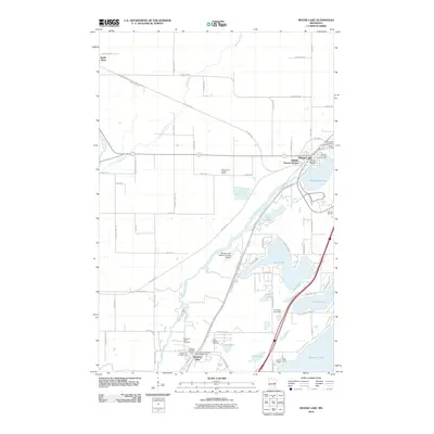
2010 Map of Moose Lake
USGS Topo · Published 2010About this map
The Moose Horn River and the corridors of the Soo Line Trl and Willard Munger Trl define the landscape of southern Carlton County in this early 21st-century survey. The hub of Moose Lake serves as a central point of interest, featuring the Moose Lake Post Office and the Moose Lake Lookout Tower, while the residential development of Hillside Terrace Homes marks the town's northern expansion.
Find a feature on this map
74 named features on this map. Tap any name to fly to it.
Don’t see what you’re looking for? This feature index may not catch every label — zoom into the map to look around manually.
Map Details
Editions of this 2010 Moose Lake Map
This is the sole edition of this map. No revisions or reprints were ever made.
Other maps of this area

1953 · Duluth
USGS Topo · 1:250,000

1956 · Barnum
USGS Topo · 1:62,500

1958 · Duluth
USGS Topo · 1:250,000

1961 · Cromwell
USGS Topo · 1:62,500

1961 · Moose Lake
USGS Topo · 1:62,500

1962 · Bruno
USGS Topo · 1:62,500

1980 · Sandstone
USGS Topo · 1:100,000

1980 · Duluth
USGS Topo · 1:100,000

1981 · Willow River
USGS Topo · 1:24,000

1981 · Kettle River
USGS Topo · 1:24,000
Featured Places
- Moose Lake, MN
- Sturgeon Lake, MN
- Kettle River, MN
- Windemere Township, MN
- Hillside Terrace Mobil Home Park, Moose Lake