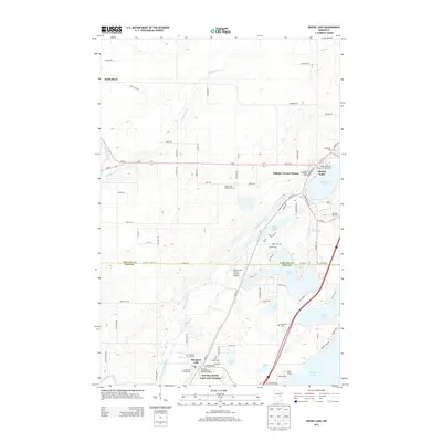
2013 Map of Moose Lake
USGS Topo · Published 2013About this map
Moose Lake and Sturgeon Lake anchor a landscape defined by its network of water and timber in the early twenty-first century. This part of Eastern Minnesota is characterized by the Moose Horn River and Kettle River drainage systems, where small settlements like Kettle River and Hillside Terrace Homes provide residential pockets amidst the wetlands and woods. The map reveals a dense concentration of community landmarks, including several rural burial grounds such as Riverside Cem and Saint Isadors Cem. The area serves as a notable recreational and transportation hub, featuring the Moose Lake Carlton County Airport and diverse lodgings ranging from Ray and Marges Resort and Campground to the YMCA Camp. Local infrastructure is marked by forestry and fire management history, evidenced by the Moose Lake Lookout Tower, while the boundary between Carlton Co and Pine Co bisects the southern lakes.
Find a feature on this map
54 named features on this map. Tap any name to fly to it.
Don’t see what you’re looking for? This feature index may not catch every label — zoom into the map to look around manually.
Map Details
Editions of this 2013 Moose Lake Map
This is the sole edition of this map. No revisions or reprints were ever made.
Other maps of this area

1953 · Duluth
USGS Topo · 1:250,000

1956 · Barnum
USGS Topo · 1:62,500

1958 · Duluth
USGS Topo · 1:250,000

1961 · Cromwell
USGS Topo · 1:62,500

1961 · Moose Lake
USGS Topo · 1:62,500

1962 · Bruno
USGS Topo · 1:62,500

1980 · Sandstone
USGS Topo · 1:100,000

1980 · Duluth
USGS Topo · 1:100,000

1981 · Willow River
USGS Topo · 1:24,000

1981 · Kettle River
USGS Topo · 1:24,000
Featured Places
- Moose Lake, MN
- Sturgeon Lake, MN
- Kettle River, MN
- Windemere Township, MN
- Hillside Terrace Mobil Home Park, Moose Lake