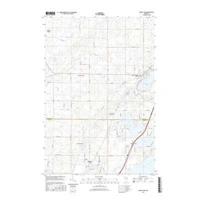
2016 Map of Moose Lake
USGS Topo · Published 2016About this map
The Moose Horn River and Kettle River dominate this 2016 survey of the glacial lake country on the Carlton and Pine County line. The settlement of Moose Lake serves as a northern hub, positioned alongside Moosehead Lake, while the community of Sturgeon Lake anchors the southern portion of the sheet. This landscape is defined by its dense network of water bodies, including Coffee Lake, Sand Lake, and Lords Lake, many of which are connected by complex tributary systems like Gillespie Brook. For those tracing local history and family heritage, the map identifies several local landmarks such as Riverside Cem, Blomskog Cem, and Saint Isidores Cem. The transition from old rail infrastructure to modern recreation is evident in the Soo Line Trl, which cuts across the townships of t46n r20w and t46n r19w, following a corridor that once fueled the region's timber and transport economy.
Find a feature on this map
103 named features on this map. Tap any name to fly to it.
Don’t see what you’re looking for? This feature index may not catch every label — zoom into the map to look around manually.
Map Details
Editions of this 2016 Moose Lake Map
This is the sole edition of this map. No revisions or reprints were ever made.
Other maps of this area

1953 · Duluth
USGS Topo · 1:250,000

1956 · Barnum
USGS Topo · 1:62,500

1958 · Duluth
USGS Topo · 1:250,000

1961 · Cromwell
USGS Topo · 1:62,500

1961 · Moose Lake
USGS Topo · 1:62,500

1962 · Bruno
USGS Topo · 1:62,500

1980 · Sandstone
USGS Topo · 1:100,000

1980 · Duluth
USGS Topo · 1:100,000

1981 · Willow River
USGS Topo · 1:24,000

1981 · Kettle River
USGS Topo · 1:24,000
Featured Places
- Moose Lake, MN
- Sturgeon Lake, MN
- Kettle River, MN
- Windemere Township, MN
- Hillside Terrace Mobil Home Park, Moose Lake