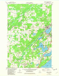
1981 Map of Moose Lake
USGS Topo · Published 1982About this map
Moose Lake serves as a central hub for this portion of Carlton and Pine Counties, where the local economy and community life revolve around a dense network of water bodies and transportation corridors. The town is flanked by Moosehead Lake and the Moose River, with the State Hospital complex and a prominent Moose Lake Lookout Tower marking the local infrastructure. To the south, the landscape transitions into the General C. C. Andrews State Forest and the residential and recreational areas surrounding Sturgeon Lake, including Camp Miller.
Find a feature on this map
56 named features on this map. Tap any name to fly to it.
Don’t see what you’re looking for? This feature index may not catch every label — zoom into the map to look around manually.
Map Details
Editions of this 1981 Moose Lake Map
This is the sole edition of this map. No revisions or reprints were ever made.
Other maps of this area

1953 · Duluth
USGS Topo · 1:250,000

1956 · Barnum
USGS Topo · 1:62,500

1958 · Duluth
USGS Topo · 1:250,000

1961 · Cromwell
USGS Topo · 1:62,500

1961 · Moose Lake
USGS Topo · 1:62,500

1962 · Bruno
USGS Topo · 1:62,500

1980 · Sandstone
USGS Topo · 1:100,000

1980 · Duluth
USGS Topo · 1:100,000

1981 · Willow River
USGS Topo · 1:24,000

1981 · Kettle River
USGS Topo · 1:24,000