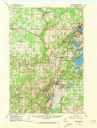
1961 Map of Moose Lake
USGS Topo · Published 1972About this map
The Kettle River carves a central path through this survey of northeastern Minnesota, anchoring a landscape where timber and rail historically drove development. Along the eastern edge, the town of Moose Lake serves as a hub for the region, featuring the large State Hospital complex and the Moose Lake Airport. The transit infrastructure of the early 1960s is clearly visible, with the Northern Pacific and Soo Line railroads providing vital connections while new road projects, including sections marked as Under Construction, signal the arrival of the modern interstate era.
Find a feature on this map
69 named features on this map. Tap any name to fly to it.
Don’t see what you’re looking for? This feature index may not catch every label — zoom into the map to look around manually.
Map Details
Editions of this 1961 Moose Lake Map
2 editions found
Other maps of this area

1953 · Duluth
USGS Topo · 1:250,000

1956 · Barnum
USGS Topo · 1:62,500

1958 · Duluth
USGS Topo · 1:250,000

1961 · Sandstone
USGS Topo · 1:62,500

1961 · Cromwell
USGS Topo · 1:62,500

1961 · Moose Lake
USGS Topo · 1:62,500

1962 · Bruno
USGS Topo · 1:62,500

1962 · Cloverdale
USGS Topo · 1:62,500

1968 · Giese
USGS Topo · 1:24,000

1969 · Arthyde
USGS Topo · 1:24,000