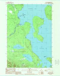
1989 Map of Moosehead
USGS Topo · Published 1989About this map
Moosehead Lake dominates this 1980s landscape, illustrating the complex geography where the Kennebec River Outlet begins its southward journey. The map captures the small settlement of Moosehead near a Gaging Sta, highlighting the area's importance for water management and resource monitoring. Large interior islands such as Deer Island and Sugar Island appear alongside more localized terrain divisions like Misery Gore and the Sandbar Tract, reflecting the unique historical land survey units of the Maine woods.
Find a feature on this map
35 named features on this map. Tap any name to fly to it.
Don’t see what you’re looking for? This feature index may not catch every label — zoom into the map to look around manually.
Map Details
Editions of this 1989 Moosehead Map
This is the sole edition of this map. No revisions or reprints were ever made.
Other maps of this area

1905 · The Forks
USGS Topo · 1:62,500

1907 · The Forks
USGS Topo · 1:62,500

1920 · Moosehead Lake
USGS Topo · 1:62,500

1921 · Brassua Lake
USGS Topo · 1:62,500

1922 · Moosehead Lake
USGS Topo · 1:62,500

1923 · Brassua Lake
USGS Topo · 1:62,500

1930 · Moosehead Lake
USGS Topo · 1:62,500

1944 · Brassua Lake
USGS Topo · 1:62,500

1944 · Moosehead Lake
USGS Topo · 1:62,500

1951 · Greenville
USGS Topo · 1:62,500
Featured Places
- Misery Gore, ME
- Sapling Township, ME
- Big Moose Township, ME
- Sandbar Tract Township, ME
- Harfords Point Township, ME