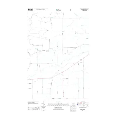
2013 Map of Moquah
USGS Topo · Published 2013About this map
Moquah and Benoit anchor this northern Wisconsin landscape, where the headwaters of the Lake Superior basin carve deep through the rural terrain. The map reveals a complex network of forest routes, including numerous Forest Service roads like FR 245 and FR 429, alongside modern corridors such as the Tri Co Corridor. Water is the defining element here, with Whittlesey Cr and N Fork Whittlesey Cr in the north and the meandering N Fish Cr and S Fish Cr dominating the southern half. Notable local landmarks like Lake Louise and McGinnis Lake sit near timber-rich areas accessed by routes like Moquah Ski Hill Rd and Moquah Pit Rd. This 2013 survey illustrates the enduring rural character of Bayfield County, showing how 21st-century infrastructure overlays a landscape still defined by its traditional drainage patterns and forest management tracts.
Find a feature on this map
60 named features on this map. Tap any name to fly to it.
Don’t see what you’re looking for? This feature index may not catch every label — zoom into the map to look around manually.
Map Details
Editions of this 2013 Moquah Map
This is the sole edition of this map. No revisions or reprints were ever made.
Other maps of this area

1942 · Ashland
USGS Topo · 1:48,000

1942 · Marengo
USGS Topo · 1:48,000

1944 · Moquah
USGS Topo · 1:48,000

1944 · Grandview
USGS Topo · 1:48,000

1945 · Marengo
USGS Topo · 1:48,000

1947 · Moquah
USGS Topo · 1:48,000

1947 · Ashland
USGS Topo · 1:48,000

1947 · Grandview
USGS Topo · 1:48,000

1953 · Ashland
USGS Topo · 1:250,000

1958 · Ashland
USGS Topo · 1:250,000