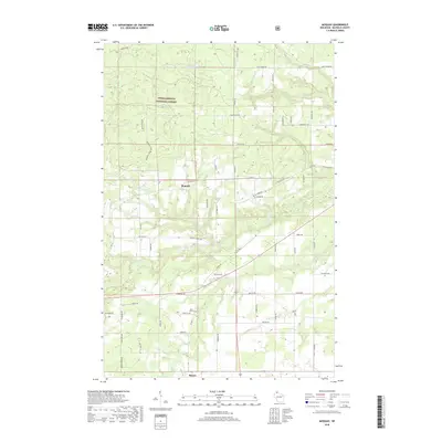
2018 Map of Moquah
USGS Topo · Published 2018About this map
Moquah and Benoit anchor this northern Wisconsin landscape, where the agricultural clearings of Bayfield County meet the dense timber of the Chequamegon National Forest. The map documents a complex drainage network feeding toward Lake Superior, including the headwaters of Whittlesey Cr and the winding course of North Fish Creek. Small water bodies like Lake Louise and McGinnis Lake dot the northern reaches, while the Saint Peters Cem provides a specific point of interest for genealogists researching the local families settled along the township's grid.
Find a feature on this map
59 named features on this map. Tap any name to fly to it.
Don’t see what you’re looking for? This feature index may not catch every label — zoom into the map to look around manually.
Map Details
Editions of this 2018 Moquah Map
This is the sole edition of this map. No revisions or reprints were ever made.
Other maps of this area

1942 · Ashland
USGS Topo · 1:48,000

1942 · Marengo
USGS Topo · 1:48,000

1944 · Moquah
USGS Topo · 1:48,000

1944 · Grandview
USGS Topo · 1:48,000

1945 · Marengo
USGS Topo · 1:48,000

1947 · Moquah
USGS Topo · 1:48,000

1947 · Ashland
USGS Topo · 1:48,000

1947 · Grandview
USGS Topo · 1:48,000

1953 · Ashland
USGS Topo · 1:250,000

1958 · Ashland
USGS Topo · 1:250,000