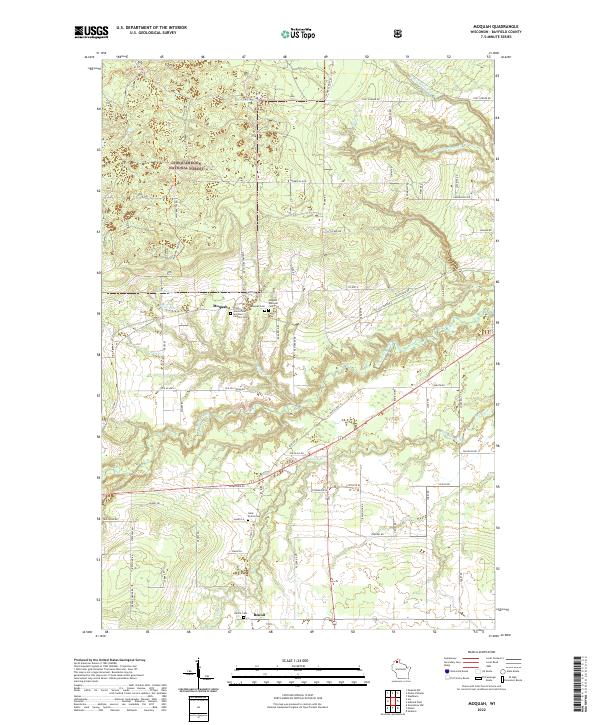
2022 Map of Moquah
USGS Topo · Published 2022About this map
The northern reaches of the Chequamegon National Forest dominate this Bayfield County landscape, where small rural settlements are linked by a network of named country roads and the Tri Co Corridor. The community of Moquah serves as a local focal point, characterized by its cluster of spiritual and memorial sites including Moquah Cem, the Moquah National Cemetery, and the Saints Peter and Paul Catholic Cemetery. Further south, the settlement of Benoit sits near the Benoit Cemetery, reflecting a pattern of small-scale agricultural and forest-based living. The geography is defined by a complex drainage system, with South Fish Creek and its many branches like S Fish Creek cutting through the terrain, alongside smaller water bodies such as Lake Louise and McGinnis Lake.
Find a feature on this map
70 named features on this map. Tap any name to fly to it.
Don’t see what you’re looking for? This feature index may not catch every label — zoom into the map to look around manually.
Map Details
Editions of this 2022 Moquah Map
This is the sole edition of this map. No revisions or reprints were ever made.
Other maps of this area

1942 · Ashland
USGS Topo · 1:48,000

1942 · Marengo
USGS Topo · 1:48,000

1944 · Moquah
USGS Topo · 1:48,000

1944 · Grandview
USGS Topo · 1:48,000

1945 · Marengo
USGS Topo · 1:48,000

1947 · Moquah
USGS Topo · 1:48,000

1947 · Ashland
USGS Topo · 1:48,000

1947 · Grandview
USGS Topo · 1:48,000

1953 · Ashland
USGS Topo · 1:250,000

1958 · Ashland
USGS Topo · 1:250,000