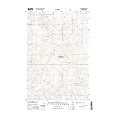
2015 Map of Moquah NW
USGS Topo · Published 2015About this map
Chequamegon National Forest encompasses this glacial landscape in northern Wisconsin, defined by an intricate network of kettle lakes and forest service roads. The topography is dominated by numerous small water bodies, including Sunken Camp Lake, Lake Lenawee, and Horseshoe Lake, which are clustered among the timbered moraines. These lakes and the headwaters of the E Fork Cranberry River reflect the region's post-glacial hydrology and its long-standing role as a managed timber and recreation resource. The 2015 mapping of this area preserves the layout of contemporary access routes like Battle Axe Rd and Ino Rd, alongside the sprawling boundaries of the National Forest. This record of the Northwoods landscape captures the remote character of the region, showing how forestry management and natural drainage patterns dictate the placement of roads and campsites across Bayfield County.
Find a feature on this map
63 named features on this map. Tap any name to fly to it.
Don’t see what you’re looking for? This feature index may not catch every label — zoom into the map to look around manually.
Map Details
Editions of this 2015 Moquah NW Map
This is the sole edition of this map. No revisions or reprints were ever made.
Other maps of this area

1943 · Port Wing
USGS Topo · 1:48,000

1943 · Iron Lake
USGS Topo · 1:48,000

1944 · Moquah
USGS Topo · 1:48,000

1944 · Cornucopia
USGS Topo · 1:48,000

1946 · Cornucopia
USGS Topo · 1:48,000

1946 · Port Wing
USGS Topo · 1:48,000

1947 · Moquah
USGS Topo · 1:48,000

1947 · Iron Lake
USGS Topo · 1:48,000

1953 · Ashland
USGS Topo · 1:250,000

1958 · Ashland
USGS Topo · 1:250,000