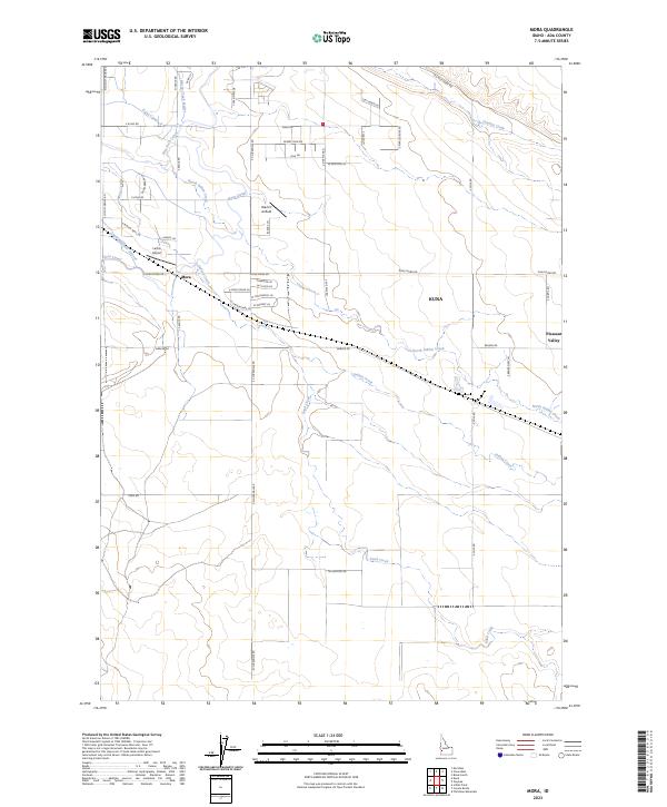
2023 Map of Mora
USGS Topo · Published 2023About this map
The settlement of Mora sits as a central junction in this landscape of Ada County, defined by its intricate network of irrigation and water management. The agricultural character of the region is evident through an extensive system of waterways, including the New York Canal, Kuna Canal, and the Mora Canal, which weave through the desert terrain alongside natural features like North Indian Creek. The importance of these water rights is further emphasized by specialized infrastructure such as the Mason Creek Feeder and the South Railroad Lateral.
Find a feature on this map
54 named features on this map. Tap any name to fly to it.
Don’t see what you’re looking for? This feature index may not catch every label — zoom into the map to look around manually.
Map Details
Editions of this 2023 Mora Map
This is the sole edition of this map. No revisions or reprints were ever made.
Other maps of this area

1892 · Boise
USGS Topo · 1:125,000

1892 · Bisuka
USGS Topo · 1:125,000

1894 · Bisuka
USGS Topo · 1:125,000

1897 · Boise
USGS Topo · 1:125,000

1953 · Cloverdale
USGS Topo · 1:24,000

1953 · Meridian
USGS Topo · 1:24,000

1954 · Boise South
USGS Topo · 1:24,000

1954 · Boise
USGS Topo · 1:62,500

1955 · Christmas Mtn
USGS Topo · 1:24,000
1955 · Coyote Butte
USGS Topo · 1:24,000