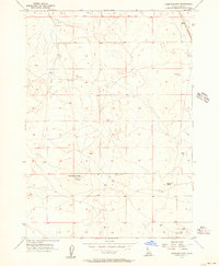
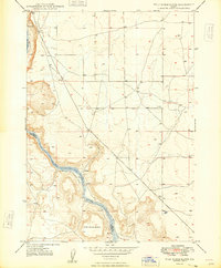
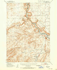
1955 Map of Christmas Mtn
USGS Topo · Published 1956About this map
Christmas Mtn serves as the central topographic focal point of this mid-1950s survey in Ada County. The landscape is defined by its open terrain and specialized land use, including a distinct Rifle Range and an associated Target located to the north. These features, along with a remote Landing Strip and several survey markers like Reptile VABM 3497, suggest a period where the area was utilized for both military or recreational training and aerial navigation.
Find a feature on this map
12 named features on this map. Tap any name to fly to it.
Don’t see what you’re looking for? This feature index may not catch every label — zoom into the map to look around manually.
Map Details
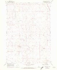
Editions of this 1955 Christmas Mtn Map
2 editions found
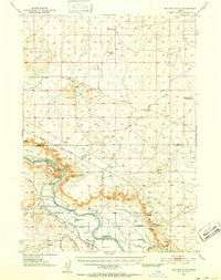
Other maps of this area

1892 · Bisuka
USGS Topo · 1:125,000

1894 · Bisuka
USGS Topo · 1:125,000
1947 · Wild Horse Butte
USGS Topo · 1:24,000
1948 · Big Foot Butte
USGS Topo · 1:24,000
1948 · Wild Horse Butte
USGS Topo · 1:24,000
1948 · Big Foot Butte
USGS Topo · 1:62,500
1948 · Little Joe Butte
USGS Topo · 1:24,000
1949 · Little Joe Butte
USGS Topo · 1:24,000
1949 · Oreana
USGS Topo · 1:62,500
1955 · Coyote Butte
USGS Topo · 1:24,000