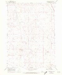
1955 Map of Christmas Mtn
USGS Topo · Published 1972About this map
Christmas Mtn rises as a prominent landmark in this high-desert region south of Boise during the mid-1950s. The landscape is characterized by volcanic and geologic formations, with notable features such as Flagstaff Butte and several subterranean sites including Higby Cave and other Caves to the southeast. The area shows evidence of early industrial activity at a Quarry near the center of the sheet. Surveyors marked a specific Target point in the northern section, while the Boise Base Line provides a foundational surveying boundary for the Idaho territory. Water is scarce in this environment, primarily limited to the ephemeral drainage of Sand Creek which winds through the northern hills. The map captures a moment before modern development, preserving the original topographic details of Ada County.
Find a feature on this map
11 named features on this map. Tap any name to fly to it.
Don’t see what you’re looking for? This feature index may not catch every label — zoom into the map to look around manually.
Map Details
Editions of this 1955 Christmas Mtn Map
2 editions found
Other maps of this area

1892 · Bisuka
USGS Topo · 1:125,000

1894 · Bisuka
USGS Topo · 1:125,000

1947 · Wild Horse Butte
USGS Topo · 1:24,000

1948 · Big Foot Butte
USGS Topo · 1:24,000

1948 · Wild Horse Butte
USGS Topo · 1:24,000

1948 · Big Foot Butte
USGS Topo · 1:62,500

1948 · Little Joe Butte
USGS Topo · 1:24,000

1949 · Little Joe Butte
USGS Topo · 1:24,000

1949 · Oreana
USGS Topo · 1:62,500

1955 · Christmas Mtn
USGS Topo · 1:24,000